South Iceland has a diverse and spectacular natural environment with a great attraction.
Southern Region is a region of Iceland. South Iceland has a diverse and spectacular natural environment with a great attraction that is easy to access and experience all year round. The great variety and the quality of services enable visitors to enjoy the best of what Iceland has to offer.
1. Thingvellir National Park
Þingvellir, anglicized as Thingvellir, is a national park in the municipality of Bláskógabyggð in southwestern Iceland, about 40 km northeast of Iceland’s capital, Reykjavík. Þingvellir is a site of historical, cultural, and geological significance, and is one of the most popular tourist destinations in Iceland.
The park lies in a rift valley that marks the crest of the Mid-Atlantic Ridge and the boundary between the North American and Eurasian tectonic plates. To its south lies Þingvallavatn, the largest natural lake in Iceland. Þingvellir is associated with the Althing, the national parliament of Iceland, which was established at the site in 930 AD. Sessions were held at the location until 1798.
Þingvellir National Park was founded in 1930, marking the 1000th anniversary of the Althing. The park was later expanded to protect the diverse and natural phenomena in the surrounding area and was designated as a World Heritage Site in 2004.
2. Seljalandsfoss
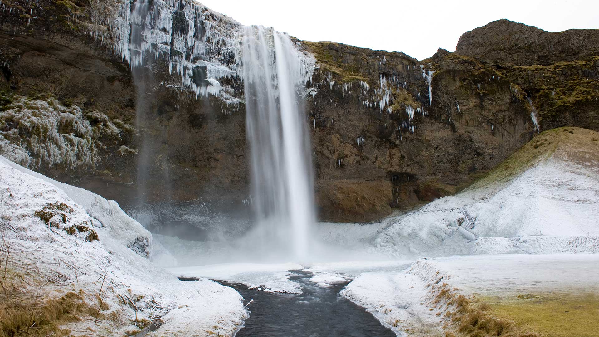
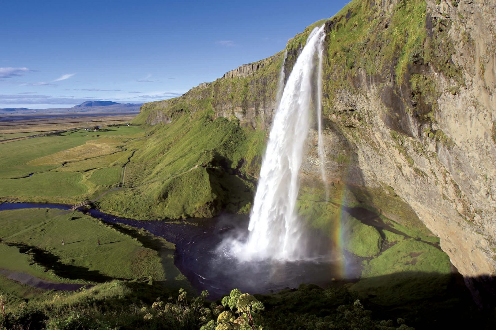
Seljalandsfoss is a waterfall in Iceland. Seljalandsfoss is located in the South Region in Iceland right by Route 1 and the road that leads to Þórsmörk Road 249. The waterfall drops 60 m and is part of the Seljalands River that has its origin in the volcano glacier Eyjafjallajökull. Visitors can walk behind the falls into a small cave.
3. Skógafoss
Skógafoss is a waterfall situated on the Skógá River in the south of Iceland at the cliffs of the former coastline. After the coastline had receded seaward, the former sea cliffs remained, parallel to the coast over hundreds of kilometers, creating together with some mountains a clear border between the coastal lowlands and the Highlands of Iceland.
4. Geysir

Geysir, sometimes known as The Great Geysir, is a geyser in southwestern Iceland. It was the first geyser described in a printed source and the first known to modern Europeans. The English word geyser derives from Geysir. The name Geysir itself is derived from the Icelandic verb geysa the verb from Old Norse. Geysir lies in the Haukadalur valley on the slopes of Laugarfjall hill, which is also the home to Strokkur geyser about 50 meters south. Eruptions at Geysir can hurl boiling water up to 70 meters in the air. However, eruptions may be infrequent and have in the past stopped altogether for years at a time.
5. Landmannalaugar
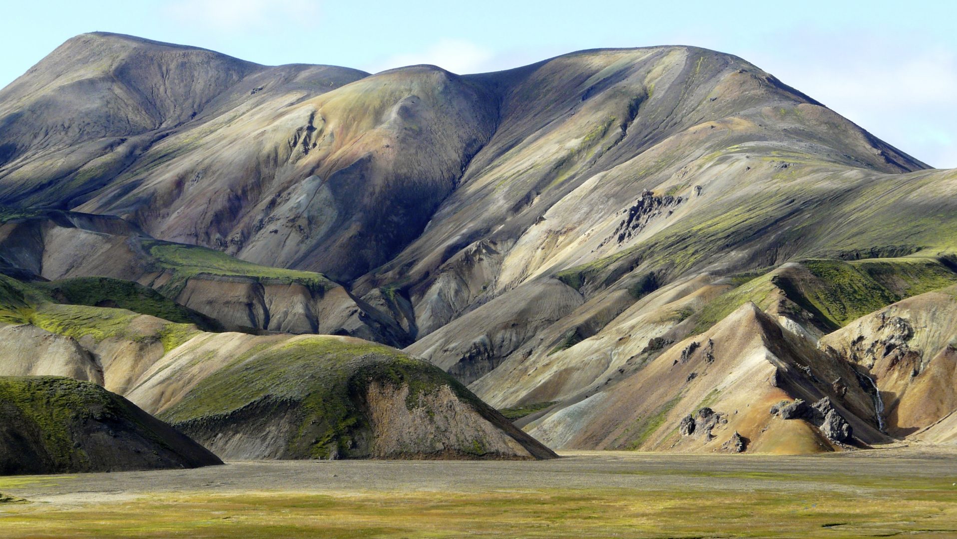
Landmannalaugar is a place in the Fjallabak Nature Reserve in the Highlands of Iceland. It is at the edge of the Laugahraun lava field, which was formed in an eruption around the year 1477. It is known for its natural geothermal hot springs and surrounding landscape. Landmannalaugar is the northern end of the Laugavegur hiking trail. The Iceland Touring Association operates a mountain hut with sleeping bag accommodation for 75 people and a public toilet with showers. During the tourist high season, there is also a small shop there that sells coffee and basic groceries, a horse tour agency. ICE-SAR highland patrol in Fjallabak operates from here. Several bus companies have regular trips to and from Landmannalaugar during the tourist season.